Weather Update: Maharashtra To Get Above Normal Rainfall, Predicts IMD
Weather Update: Rainfall Predicted Across Maharashtra On Tuesday; Yellow Alert Issued For 12 Districts
Pune, May 28, 2025 — The India Meteorological Department (IMD) has forecast a wetter monsoon season for Maharashtra this year, with all four meteorological subdivisions of the state — Konkan & Goa, Central Maharashtra, Marathwada, and Vidarbha — expected to receive above-normal rainfall between June and September.
According to IMD’s latest long-range forecast released in New Delhi, Central India, including Maharashtra, as well as southern parts of the country, are likely to experience a stronger-than-usual monsoon. The forecast, presented by senior officials including IMD Director General Mrutyunjay Mohapatra and Earth Sciences Secretary M. Ravichandran, was based on a newly adopted multi-model ensemble (MME) forecasting system.
The subdivision-wise predictions indicate that Marathwada and Central Maharashtra are likely to receive rainfall at 112% and 110% of the normal level, respectively. Konkan & Goa is expected to receive rainfall at 107% of normal, and Vidarbha is likely to see around 109% of its average monsoon rainfall.

The monsoon core zone, which covers major rain-fed agricultural areas in India, is also predicted to see above-normal precipitation, potentially benefiting crop production and groundwater recharge.

Commenting on the early monsoon onset, Mohapatra attributed the progress to favorable oceanic and atmospheric conditions. A system forming in the Bay of Bengal is expected to support further advancement of the monsoon. While consistent rainfall is predicted over the next couple of days, a brief pause may follow — though IMD officials said it’s too early to predict any monsoon break.
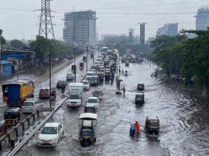
In Pune, the city witnessed moderate widespread showers on Tuesday. IMD recorded 15.7 mm of rainfall in Shivajinagar and 33.5 mm in Wadgaonsheri, the highest for the city. Chinchwad saw 27.5 mm over the past 48 hours. Rain in the ghat regions has slightly reduced due to limited moisture inflow from the Arabian Sea.
Explaining the current weather systems, IMD Pune’s senior meteorologist S.D. Sanap noted a low-pressure zone over the Bay of Bengal and a cyclonic circulation affecting southern Chhattisgarh and eastern Vidarbha. A trough line also runs across north Konkan and the nearby Arabian Sea. These developments are expected to bring widespread rain to Maharashtra’s coastal belt, prompting an orange alert. Pune city itself is likely to see cloudy skies with light rain in the next two days, but no weather alert has been issued.
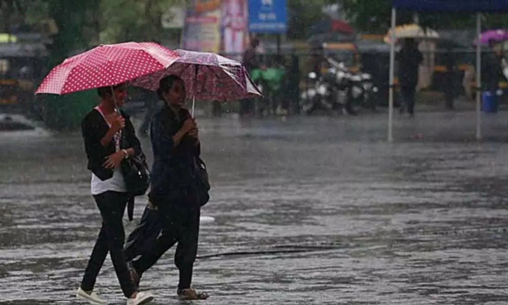
Meanwhile, rainfall activity has led to a notable dip in temperatures across Pune. The city recorded a maximum temperature of 24.8°C on Tuesday, significantly lower than the 28.4°C observed on May 26 and 11.5°C below the seasonal average. Lohegaon recorded 26.1°C, which is 10.2°C below normal. This unseasonal drop in mercury levels has brought a winter-like chill to the city — a rare occurrence in May, last seen in 2015.
IMD has issued a yellow alert for isolated moderate to heavy rainfall in Pune’s ghats until May 29. No alerts have been announced for May 30 and 31.