Maharashtra Weather Update: Thunder and Rain Expected in Vidarbha, Marathwada
Maharashtra Weather Alert: IMD Predicts Rain, Thunderstorms Across Mumbai and State During Diwali
Weather conditions across the state are expected to shift notably in the coming days, with the India Meteorological Department (IMD) issuing Yellow and Orange Alerts for several districts. Forecasts indicate the likelihood of thunderstorms, lightning, gusty winds, and heavy rainfall, particularly in parts of Marathwada and Vidarbha. These alerts come following a brief lull in monsoon activity, suggesting a resurgence of moderate to intense weather systems.
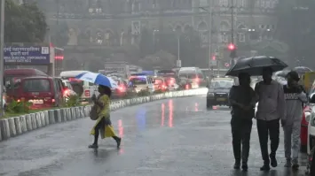
After a stretch of dry and hot days, parts of Maharashtra began witnessing light to moderate rainfall over the weekend. However, heat and humidity continue to dominate, especially in regions with little to no precipitation. The highest temperatures in the state were recorded in Dhule and Chandrapur, both hitting 33°C, making afternoon conditions particularly harsh.
This shift in conditions has been attributed to active monsoonal systems and cyclonic circulations, which are gradually regaining strength. A low-pressure trough is currently stretching from Faridkot in the north to Arunachal Pradesh in the east, passing through Ludhiana, Najibabad, Shahjahanpur, Ballia, and Jalpaiguri. Additionally, cyclonic winds are circulating near the Gujarat coast at 3.1 km altitude, and around Karnataka at elevations between 4.5 and 5.8 km. A new low-pressure area is likely to develop in the Bay of Bengal by August 13, which could further intensify rainfall across the state.

Rain Forecasts and Alerts – District Wise Breakdown
Yellow Alert for August 11: Thunderstorms with Lightning Expected
The IMD has placed several districts under a Yellow Alert for August 11, warning residents of light to moderate rainfall, thunderstorms, and lightning. These include:
Solapur
Dharashiv (Osmanabad)
Latur
Nanded
Yavatmal
Nagpur
Bhandara
Gondia
Chandrapur
Gadchiroli
In addition, thunderstorms with rain are likely in the following districts:
Nandurbar
Dhule
Nashik
Chhatrapati Sambhajinagar (Aurangabad)
Jalna
Beed
Parbhani
Hingoli
Region-wise Weather Outlook
Konkan Region (August 11):
Districts including Palghar, Thane, Mumbai, Raigad, Ratnagiri, and Sindhudurg are expected to experience light to moderate showers accompanied by thunder.
Western Maharashtra:
Cities such as Pune, Kolhapur, Satara, Sangli, and the Ghat regions are forecasted to receive thunder-accompanied showers ranging from light to moderate intensity.
Notably, Solapur is under special watch due to the potential for heavy rain with thunderstorms and strong winds. A Yellow Alert has been issued for this district specifically.
Detailed Zone Alerts
Marathwada Region:
Light to moderate showers with thunder expected in:
Chhatrapati Sambhajinagar
Jalna
Parbhani
Beed
Hingoli
Thunderstorms with gusty winds and lightning likely in:
Nanded
Latur
Dharashiv
(Yellow Alert in effect)
North Maharashtra:
Scattered light to moderate showers expected in:
Nashik
Dhule
Nandurbar
Jalgaon
Ahilyanagar
Vidarbha Region:
Thunderstorms and gusty winds anticipated in:
Nagpur
Bhandara
Chandrapur
Gadchiroli
Gondia
Yavatmal
(Yellow Alert issued)
No significant rainfall expected in:
Akola
Amravati
Buldhana
Wardha
Washim
However, the intensity of rainfall in Vidarbha is likely to pick up from August 13.
What’s Fueling These Changes?
This resurgence in rain activity can be traced back to the strengthening monsoonal dynamics over the Indian subcontinent. A cyclonic circulation over western Uttar Pradesh and the expected formation of a low-pressure system in the Bay of Bengal by mid-week are triggering these regional weather disturbances.
These evolving systems are expected to fuel rainfall over the next few days, especially in Vidarbha, Marathwada, and Western Maharashtra.