ISRO & NHAI to collaborate for ‘Green Cover Index’ for national highways
ISRO & NHAI to collaborate for ‘Green Cover Index’ for national highways
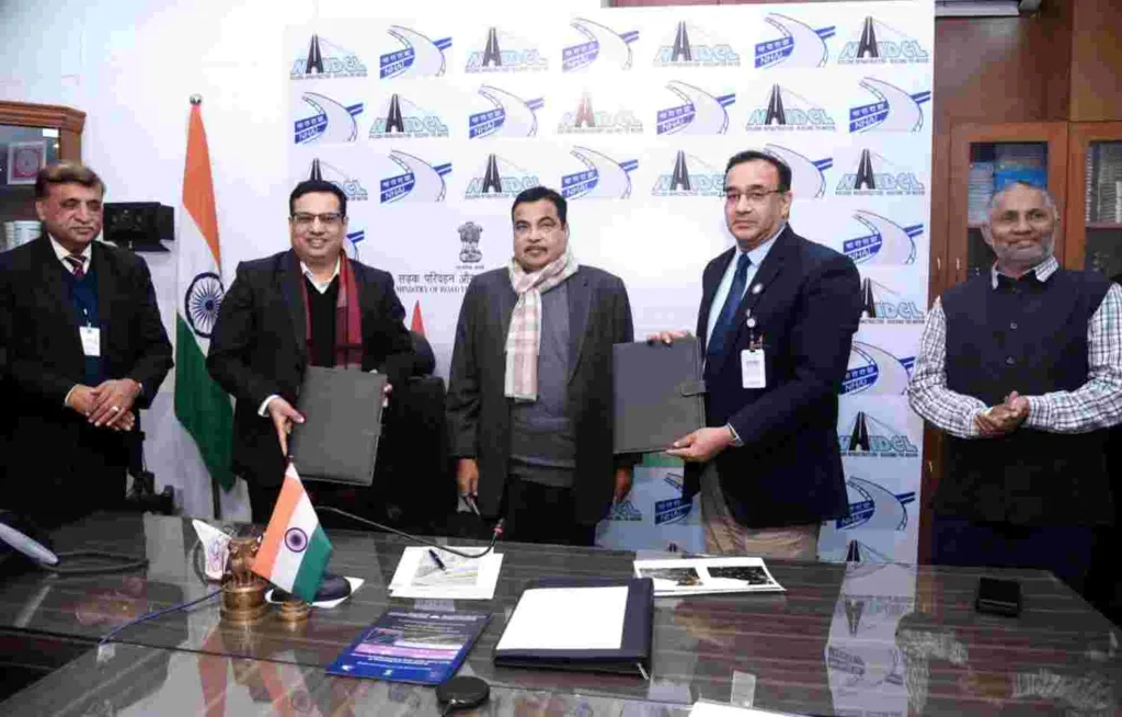
To create and report a ‘Green Cover Index’ for the vast network of Indian National Highways, the National Highways Authority of India (NHAI) and ISRO’s National Remote Sensing Centre (NRSC) have signed a Memorandum of Understanding (MoU).
In order to promote environmental awareness and sustainable development, the Indian Space Research Organization (ISRO) satellite center data will be utilized by NHAI over the course of three years to map the entire highway network.
As per further information from the X handle of Nitin Gadkari, “NHAI collaborates with ISRO’s National Remote Sensing Centre in a ????-???????????????? ???????????? ???????? ???????????????????????? ???????????? ???????????????????????????? ???? “???????????????????? ???????????????????? ????????????????????” for India’s extensive National Highways network, ???????????????????????????????????? ???????????????????????????????????????????????????? ???????????????????????????????????? ???????????? ???????????????????????????????????????????? ????????????????????????????????????nt. In the inaugural assessment, the endeavour seeks to regionally ???????????????????????????????? ???????????? ???????????????????? ???????????????????? ????????????????????. Subsequent cycles will ???????????????????????? ???????????????????????????????????????? ???????????????????????????????????????????????????? ???????? ???????????????????????? ???????????????????? ???????????????????? ???????????????????????? ???????????????????????????????? ????????????????????????????????.”

???????????? ???????????????????????????????????? ???????????????????? ???????????????? ???????????????????????? ???????????????????????????????????????????? ???????????????????????????????? ???????? ???????????????????????????????? ????????????????????????????????, ???????????????????????????? ???????????????????????????????????? ????????????????????????????????????????????????????. With a meticulous 1 km granularity, this initiative reflects a dedicated commitment to evaluating NHAI’s pivotal role in advancing the ecological transformation of highways, bolstering national environmental prosperity.”
Using high-resolution satellite imagery, the NRSC will estimate green cover across all of India, a process known as the “Green Cover Index” for National Highways.
Emerging technologies will be used in the index to improve plantation management and monitoring, as well as to supplement in-situ data collection. This will include NHAI performance audits.
Additionally, the novel method looks to be a strong and dependable mechanism that offers a quick and affordable way to produce a macro-level estimate along national highways.
The index’s results will make it easier to compare and rank different national highways in order to make timely and recurring interventions. Granular metrics could be produced for specific projects or packages as well since green cover would be estimated for every 1 km of the country’s highways.
Shreyas Vange