
Heatwave Peaks, Rain Nears: Satellite Captures 2,500-Km-Wide Cloud Band Moving Towards India
Heatwave Peaks, Rain Nears: Satellite Captures 2,500-Km-Wide Cloud Band Moving Towards India
Northern India continued to reel under severe heatwave conditions on Thursday even as meteorologists observed signs of major weather changes developing across the region. A day after Rajasthan’s Sri Ganganagar recorded a scorching 48.2 degrees Celsius — reportedly among the highest temperatures recorded globally — satellite imagery has now revealed a massive cloud formation stretching across large parts of north and central India.
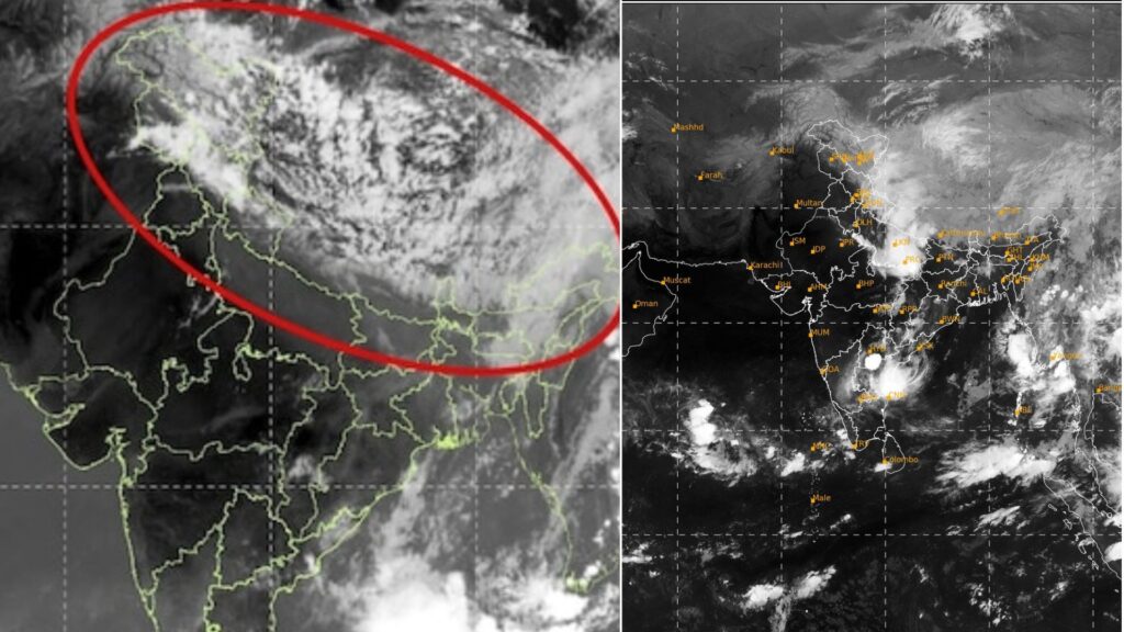
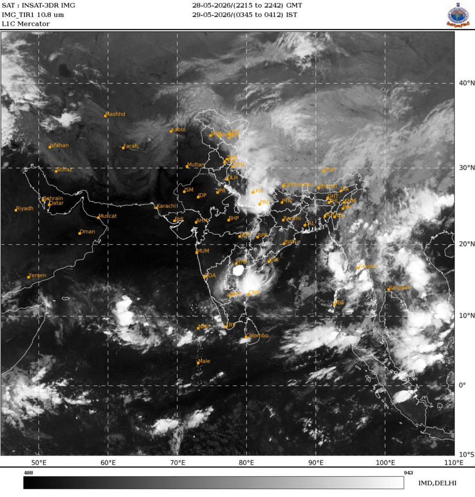
According to the latest thermal infrared images captured by India’s INSAT-3DS weather satellite, a dense cloud band currently extends from Pakistan and northwest India across Punjab, Haryana, Delhi and Uttar Pradesh before spreading further into central and eastern India towards the Bay of Bengal.
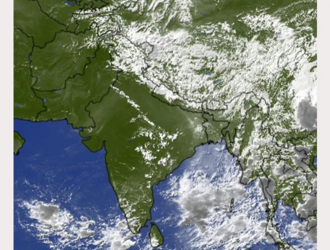
Weather experts say the expansive cloud structure indicates an active interaction between a western disturbance and moisture inflow from both the Arabian Sea and the Bay of Bengal. The cloud system is believed to span nearly 2,000 to 2,500 kilometres from west to east, making it one of the most extensive pre-monsoon cloud formations observed this season.

Thunderstorms, Rain And Dust Storms Likely
Meteorologists say the brightest white patches visible in the infrared satellite imagery represent extremely cold cloud tops — a strong indication of towering thunderstorm systems developing high in the atmosphere. Such formations are often associated with heavy rainfall, lightning activity, hailstorms and strong gusty winds.
The satellite imagery also captured a noticeable cyclonic circulation over northern Pakistan and adjoining Jammu and Kashmir. Experts believe this feature is linked to an active western disturbance moving across the western Himalayan region.
As the system draws moisture from both surrounding seas, it is helping organise widespread cloud development over the Indo-Gangetic plains after days of intense heatwave conditions across Rajasthan, Delhi, Haryana and parts of central India.
Heatwave To Ease In Several Regions
Weather experts say the combination of extremely high surface temperatures and incoming moisture has created strong atmospheric instability over north India. Such conditions are favourable for the rapid formation of massive thunderstorm clusters, often visible from space as large cloud shields.
Forecasters predict that several parts of north India may witness thunderstorms, lightning strikes, dust storms and scattered rainfall over the coming days, bringing partial relief from the ongoing heatwave.
Mountain states including Himachal Pradesh, Uttarakhand and Jammu and Kashmir are also likely to receive moderate to heavy rainfall under the influence of the western disturbance.
Meanwhile, the southwest monsoon continues its gradual advance over southern seas surrounding India. Although the monsoon has not yet officially reached north India, the increasing cloud activity suggests that moisture transport into the northern plains is strengthening earlier than expected this season.